Te Whare Wānaka o Aoraki Lincoln University researchers Dr Richard Morris and Dr Shannon Davis have secured funding from the Natural Hazards Commission Toka Tū Ake for a three-year research programme examining how communities can adapt land use to the physical characteristics and constraints of flood-prone landscapes.
The programme, Adaptive land use transitions: defining floodplain carrying capacity for smarter land use in the Tūtaekurī floodplain, will develop a spatial framework for understanding which parts of a floodplain are best suited to residential, productive and other land uses.
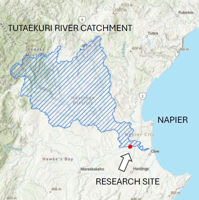
Using the Tūtaekurī floodplain in Hawke's Bay as a case study, the research brings together flood behaviour, mātauranga Māori, infrastructure and servicing constraints, and spatial land-use planning. The programme draws on an established research collaboration between Lincoln University and Land and Water Science, combining landscape-scale physiographic analysis with spatial assessment of land-use opportunities and constraints.
“The underlying idea is relatively simple: listening to the landscape before imposing development upon it,” says Dr Morris. “Flood management in Aotearoa has traditionally relied heavily on engineered protection, including stopbanks. These structures play an important role in reducing flood damage, but they cannot eliminate risk, particularly as the frequency and severity of extreme events change.
“Our research asks whether a better understanding of the landscape can help us make more informed decisions about where and how we develop, and how engineered protection, nature-based solutions and different land uses might work together.”
The research will focus on Waiohiki, a community severely affected by Cyclone Gabrielle. Recent flood protection works, associated land exchange arrangements and proposals for papakāinga development provide a practical setting for examining how flood risk, infrastructure and future land-use decisions interact. Researchers will work alongside mana whenua and the Waiohiki community, local government, neighbouring landowners and other interested parties.
“The challenge is not simply to protect existing development, but to understand what different parts of a floodplain can safely and persistently support,” says Dr Morris. “That means considering the underlying physical characteristics of the land, how water moves through it and the consequences of different land-use over time.”
The programme will develop spatial diagnostics and test alternative land-use arrangements at both floodplain and property scales, helping identify where development may be appropriate, conditional or significantly constrained. The researchers hope the findings will support more informed investment and planning decisions, reduce long-term exposure to flood damage and natural hazard costs and improve the prospects for maintaining insurability in flood-prone communities.